
Longview topographic map
Click on the map to display elevation.
About this map
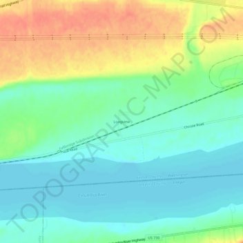
Name: Longview topographic map, elevation, terrain.
Location: Longview, Benton County, Washington, United States (45.90902 -119.43335 45.94902 -119.39335)
Average elevation: 325 ft
Minimum elevation: 259 ft
Maximum elevation: 433 ft
Benton County trails, hiking, mountain biking, running and outdoor activities
Other topographic maps
Click on a map to view its topography, its elevation and its terrain.