
Thank you for supporting this site ❤️
Make a donation
Make a donation
Gear up for your next adventure:
As an Amazon Associate, this site earns from qualifying purchases at no extra cost to you.
Bestensee topographic map
Click on the map to display elevation.
Thank you for supporting this site ❤️
Make a donation
Make a donation
Gear up for your next adventure:
As an Amazon Associate, this site earns from qualifying purchases at no extra cost to you.
About this map
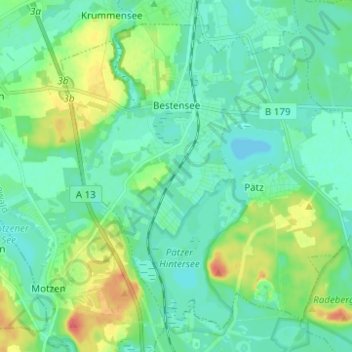
Name: Bestensee topographic map, elevation, terrain.
Location: Bestensee, Dahme-Spreewald, Brandenburg, 15741, Deutschland (52.19459 13.58721 52.26043 13.71105)
Average elevation: 144 ft
Minimum elevation: 102 ft
Maximum elevation: 269 ft
Thank you for supporting this site ❤️
Make a donation
Make a donation
Gear up for your next adventure:
As an Amazon Associate, this site earns from qualifying purchases at no extra cost to you.