Geolocate

Womack topographic map

Click on the map to display elevation.

About this map

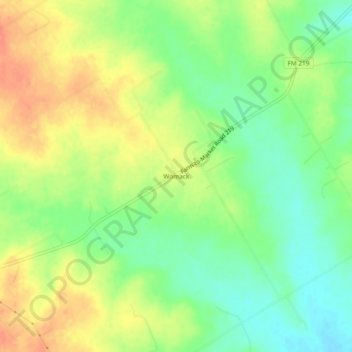
Name: Womack topographic map, elevation, terrain.

Location: Womack, Bosque County, Texas, United States (31.81710 -97.51613 31.85710 -97.47613)

Average elevation: 823 ft

Minimum elevation: 751 ft

Maximum elevation: 896 ft

Bosque County trails, hiking, mountain biking, running and outdoor activities

Other topographic maps

Click on a map to view its topography, its elevation and its terrain.

Iredell

United States > Texas > Bosque County

Average elevation: 912 ft

Walnut Springs

United States > Texas > Bosque County

Average elevation: 942 ft

Cranfills Gap

United States > Texas > Bosque County

Average elevation: 997 ft

Meridian

United States > Texas > Bosque County

Average elevation: 804 ft

Morgan

United States > Texas > Bosque County

Average elevation: 745 ft

Clifton

United States > Texas > Bosque County

Average elevation: 715 ft

Gear up for your next adventure:

📦Dry Bags Set - Waterproof storage for electronics and clothes
🧣Merino Neck Gaiters - Multi-functional headwear for wind and sun protection
🦟Ultrasonic Repellers - Create a bug-free zone at your camp or rest stop
🧭Hiking Compass - Precision compass for reliable navigation in the wilderness
🥩Freeze-Dried Meals - Nutritious and lightweight food for remote expeditions

As an Amazon Associate, this site earns from qualifying purchases at no extra cost to you.