
Thank you for supporting this site ❤️
Make a donation
Make a donation
Gear up for your next adventure:
As an Amazon Associate, this site earns from qualifying purchases at no extra cost to you.
Quintas topographic map
Click on the map to display elevation.
Thank you for supporting this site ❤️
Make a donation
Make a donation
Gear up for your next adventure:
As an Amazon Associate, this site earns from qualifying purchases at no extra cost to you.
About this map
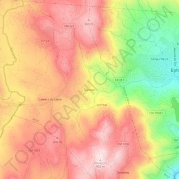
Name: Quintas topographic map, elevation, terrain.
Location: Quintas, Beça, Boticas, Vila Real, 5460-322, Portugal (41.66385 -7.71110 41.70385 -7.67110)
Average elevation: 2,372 ft
Minimum elevation: 1,496 ft
Maximum elevation: 2,936 ft
Thank you for supporting this site ❤️
Make a donation
Make a donation
Gear up for your next adventure:
As an Amazon Associate, this site earns from qualifying purchases at no extra cost to you.