Geolocate

Brambleton topographic map

Click on the map to display elevation.

About this map

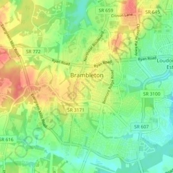
Name: Brambleton topographic map, elevation, terrain.

Location: Brambleton, Loudoun County, Virginia, United States (38.95537 -77.56024 39.00579 -77.50036)

Average elevation: 328 ft

Minimum elevation: 256 ft

Maximum elevation: 446 ft

Loudoun County trails, hiking, mountain biking, running and outdoor activities

Gear up for your next adventure:

😴Insulated Sleeping Pads - Compact and warm pads for high-elevation camping
🧦Hiking Socks - Comfortable socks to prevent blisters on long hikes
📻Weather Alert Radios - Stay informed of storm risks while off-the-grid
🚪Portable Camp Chair - Foldable chair for comfort at camp
📶Satellite Messenger - Communication device off‑grid

As an Amazon Associate, this site earns from qualifying purchases at no extra cost to you.