Geolocate

Hilltop topographic map

Click on the map to display elevation.

About this map

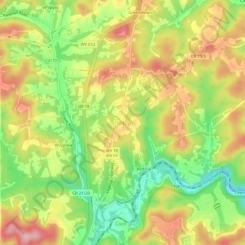
Name: Hilltop topographic map, elevation, terrain.

Location: Hilltop, Fayette County, West Virginia, 25855, United States (37.92289 -81.17094 37.96289 -81.13094)

Average elevation: 1,795 ft

Minimum elevation: 1,499 ft

Maximum elevation: 2,080 ft

Fayette County trails, hiking, mountain biking, running and outdoor activities

Other topographic maps

Click on a map to view its topography, its elevation and its terrain.

Ansted

United States > West Virginia > Fayette County

Average elevation: 1,572 ft

Powellton

United States > West Virginia > Fayette County

Average elevation: 1,552 ft

Smithers

United States > West Virginia > Fayette County

Average elevation: 1,119 ft

Pax

United States > West Virginia > Fayette County

Average elevation: 1,821 ft

Montgomery

United States > West Virginia > Fayette County

Average elevation: 1,106 ft

Gear up for your next adventure:

🏔️Mountain Trail Maps - High‑detail maps for popular peaks
🛌Ultralight Sleeping Bags - Compact down bags for cold nights in the wilderness
🛠️Outdoor Gear Repair Kit - Essential tools to fix gear on the trail
🥾Men's Hiking Boots - Durable, waterproof footwear for rugged terrain and steep inclines
📷Action Camera - Capture your outdoor adventures in HD

As an Amazon Associate, this site earns from qualifying purchases at no extra cost to you.