Geolocate

Titus topographic map

Click on the map to display elevation.

About this map

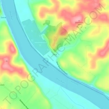
Name: Titus topographic map, elevation, terrain.

Location: Titus, Harrison County, Indiana, United States (38.03423 -86.27608 38.07423 -86.23608)

Average elevation: 548 ft

Minimum elevation: 381 ft

Maximum elevation: 823 ft

Harrison County trails, hiking, mountain biking, running and outdoor activities

Other topographic maps

Click on a map to view its topography, its elevation and its terrain.

Lanesville

United States > Indiana > Harrison County

Average elevation: 784 ft

New Amsterdam

United States > Indiana > Harrison County

Average elevation: 495 ft

New Middletown

United States > Indiana > Harrison County

Average elevation: 705 ft

Crandall

United States > Indiana > Harrison County

Average elevation: 712 ft

Laconia

United States > Indiana > Harrison County

Average elevation: 659 ft

Gear up for your next adventure:

GPS Sports Watch - GPS watch for running, hiking and training
🔦LED Headlamp - Bright and durable LED headlamp for night navigation
📚USA Hiking Guide Books - Top trail guides and map books
🛠️Outdoor Gear Repair Kit - Essential tools to fix gear on the trail
🦟Ultrasonic Repellers - Create a bug-free zone at your camp or rest stop

As an Amazon Associate, this site earns from qualifying purchases at no extra cost to you.