
Ramsey topographic map
Click on the map to display elevation.
About this map
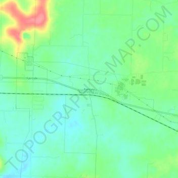
Name: Ramsey topographic map, elevation, terrain.
Location: Ramsey, Harrison County, Indiana, 47166, United States (38.30368 -86.17470 38.34368 -86.13470)
Average elevation: 725 ft
Minimum elevation: 643 ft
Maximum elevation: 912 ft
Harrison County trails, hiking, mountain biking, running and outdoor activities
Other topographic maps
Click on a map to view its topography, its elevation and its terrain.