
旧堡羌族乡 topographic map
Interactive map
Click on the map to display elevation.
About this map
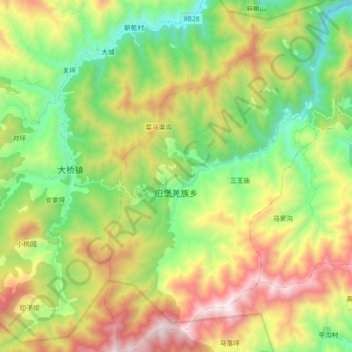
Name: 旧堡羌族乡 topographic map, elevation, terrain.
Location: 旧堡羌族乡, 平武县, 绵阳市, 四川省, 中国 (32.29899 104.35489 32.45220 104.48933)
Average elevation: 5,295 ft
Minimum elevation: 3,215 ft
Maximum elevation: 8,504 ft
Other topographic maps
Click on a map to view its topography, its elevation and its terrain.