
Make a donation
Gear up for your next adventure:
As an Amazon Associate, this site earns from qualifying purchases at no extra cost to you.
Schwaighofen topographic map
Click on the map to display elevation.
Make a donation
Gear up for your next adventure:
As an Amazon Associate, this site earns from qualifying purchases at no extra cost to you.
About this map
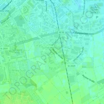
Name: Schwaighofen topographic map, elevation, terrain.
Location: Schwaighofen, Neu-Ulm, Landkreis Neu-Ulm, Bayern, Deutschland (48.37693 10.01825 48.38702 10.02906)
Average elevation: 1,558 ft
Minimum elevation: 1,542 ft
Maximum elevation: 1,572 ft
Make a donation
Gear up for your next adventure:
As an Amazon Associate, this site earns from qualifying purchases at no extra cost to you.
Other topographic maps
Click on a map to view its topography, its elevation and its terrain.
Schloss
Deutschland > Bayern > Landkreis Neu-Ulm > Neu-Ulm > Holzschwang
Holzschwang liegt am östlichen Rande des Höhenzuges zwischen Iller und Roth auf einer Höhe zwischen 490 und 520 m ü. NN und bildet den süd-östlichst gelegenen Ortsteil Neu-Ulms. Die Entfernung zum Stadtzentrum beträgt rund 10 km über die unmittelbar am westlichen Ortsrand entlang verlaufende…
Average elevation: 1,650 ft