
Thank you for supporting this site ❤️
Make a donation
Make a donation
Gear up for your next adventure:
As an Amazon Associate, this site earns from qualifying purchases at no extra cost to you.
Balibrea topographic map
Click on the map to display elevation.
Thank you for supporting this site ❤️
Make a donation
Make a donation
Gear up for your next adventure:
As an Amazon Associate, this site earns from qualifying purchases at no extra cost to you.
About this map
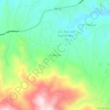
Name: Balibrea topographic map, elevation, terrain.
Location: Balibrea, Siguatepeque, Comayagua, Honduras (14.55063 -87.91563 14.59063 -87.87563)
Average elevation: 4,219 ft
Minimum elevation: 3,615 ft
Maximum elevation: 5,358 ft
Thank you for supporting this site ❤️
Make a donation
Make a donation
Gear up for your next adventure:
As an Amazon Associate, this site earns from qualifying purchases at no extra cost to you.