Geolocate

Wolbach topographic map

Click on the map to display elevation.

About this map

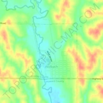
Name: Wolbach topographic map, elevation, terrain.

Location: Wolbach, Greeley County, Nebraska, United States (41.39364 -98.40280 41.40824 -98.38711)

Average elevation: 1,909 ft

Minimum elevation: 1,827 ft

Maximum elevation: 2,005 ft

Greeley County trails, hiking, mountain biking, running and outdoor activities

Gear up for your next adventure:

🎒Waterproof Dry Bags - Keep your electronics and maps dry inside your pack
📷Action Camera - Capture your outdoor adventures in HD
🧭Pro Hiking Compasses - High-accuracy liquid-filled compasses for topographic orientation
🧭Orienteering Set - Complete compass and map reading kit
🧯Emergency Survival Kit - All‑in‑one survival essentials for the backcountry

As an Amazon Associate, this site earns from qualifying purchases at no extra cost to you.