
Port O'Connor topographic map
Click on the map to display elevation.
About this map
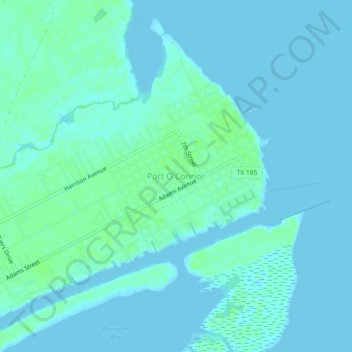
Name: Port O'Connor topographic map, elevation, terrain.
Location: Port O'Connor, Calhoun County, Texas, 77982, United States (28.42648 -96.43411 28.46648 -96.39411)
Average elevation: 10 ft
Minimum elevation: -7 ft
Maximum elevation: 26 ft
Calhoun County trails, hiking, mountain biking, running and outdoor activities