Geolocate

Mineola topographic map

Click on the map to display elevation.

About this map

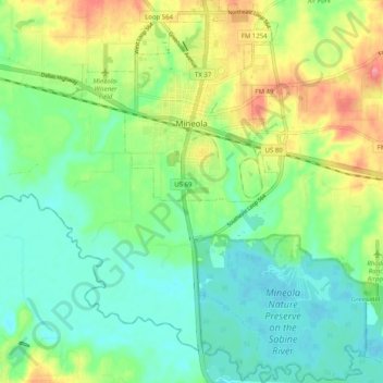
Name: Mineola topographic map, elevation, terrain.

Location: Mineola, Wood County, Texas, 75773, United States (32.60565 -95.51713 32.69082 -95.43870)

Average elevation: 381 ft

Minimum elevation: 292 ft

Maximum elevation: 541 ft

Wood County trails, hiking, mountain biking, running and outdoor activities

Other topographic maps

Click on a map to view its topography, its elevation and its terrain.

Perryville

United States > Texas > Wood County

Average elevation: 453 ft

Holly Lake Ranch

United States > Texas > Wood County

Average elevation: 400 ft

Gear up for your next adventure:

🧭Hiking Compass - Precision compass for reliable navigation in the wilderness
🎒Day Hiking Backpack - Lightweight backpack perfect for day trips and outdoor adventures
🍳Camping Cook Set - Complete cookware for outdoor meals
Solar GPS Watches - Advanced multisport watches with built-in topographic maps
🧢Outdoor Hiking Hat - Sun protection hat for outdoor explorers

As an Amazon Associate, this site earns from qualifying purchases at no extra cost to you.