
Thank you for supporting this site ❤️
Make a donation
Make a donation
Gear up for your next adventure:
As an Amazon Associate, this site earns from qualifying purchases at no extra cost to you.
Hasanabad RD topographic map
Click on the map to display elevation.
Thank you for supporting this site ❤️
Make a donation
Make a donation
Gear up for your next adventure:
As an Amazon Associate, this site earns from qualifying purchases at no extra cost to you.
About this map
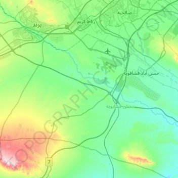
Name: Hasanabad RD topographic map, elevation, terrain.
Location: Hasanabad RD, Fashapuyeh District, Rey County, Iran (35.16683 50.84317 35.49280 51.34011)
Average elevation: 3,530 ft
Minimum elevation: 2,871 ft
Maximum elevation: 6,302 ft
Thank you for supporting this site ❤️
Make a donation
Make a donation
Gear up for your next adventure:
As an Amazon Associate, this site earns from qualifying purchases at no extra cost to you.