Geolocate

Aguso topographic map

Click on the map to display elevation.

About this map

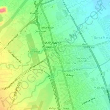
Name: Aguso topographic map, elevation, terrain.

Location: Aguso, Mabalacat, Pampanga, Central Luzon, 2010, Philippines (15.20063 120.55437 15.24063 120.59437)

Average elevation: 338 ft

Minimum elevation: 246 ft

Maximum elevation: 492 ft

Gear up for your next adventure:

🧴Hand Sanitizer - Keep hands clean while hiking
🧯Portable Fire Pit - Compact fire pit for camping spots
🥤Water Filter Bottle - All‑in‑one filter bottle for safe hydration
📦Dry Bags Set - Waterproof storage for electronics and clothes
🪶Survival Guide Book - Expert advice for emergency preparedness

As an Amazon Associate, this site earns from qualifying purchases at no extra cost to you.