Geolocate

Katao topographic map

Click on the map to display elevation.

About this map

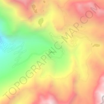
Name: Katao topographic map, elevation, terrain.

Location: Katao, Chungthang, North Sikkim District, Sikkim, India (27.65142 88.79409 27.69142 88.83409)

Average elevation: 14,780 ft

Minimum elevation: 11,677 ft

Maximum elevation: 17,385 ft

Gear up for your next adventure:

🦶Hiking Gaiters - Keep debris and water out of your boots
🧣Hiking Neck Gaiter - Multi‑use neck protection for outdoor weather
🧥Men's Rain Shells - Premium waterproof and breathable jackets for mountain weather
🧭Pro Hiking Compasses - High-accuracy liquid-filled compasses for topographic orientation
🪑Portable Camp Table - Compact table for campsite meals

As an Amazon Associate, this site earns from qualifying purchases at no extra cost to you.