
Thank you for supporting this site ❤️
Make a donation
Make a donation
Gear up for your next adventure:
As an Amazon Associate, this site earns from qualifying purchases at no extra cost to you.
Delgaditas topographic map
Click on the map to display elevation.
Thank you for supporting this site ❤️
Make a donation
Make a donation
Gear up for your next adventure:
As an Amazon Associate, this site earns from qualifying purchases at no extra cost to you.
About this map
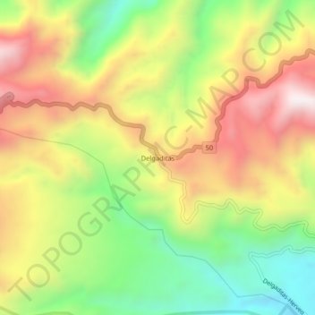
Name: Delgaditas topographic map, elevation, terrain.
Location: Delgaditas, Herveo, Nevados, Tolima, Colombia (5.07874 -75.25622 5.11874 -75.21622)
Average elevation: 7,982 ft
Minimum elevation: 6,594 ft
Maximum elevation: 9,449 ft
Thank you for supporting this site ❤️
Make a donation
Make a donation
Gear up for your next adventure:
As an Amazon Associate, this site earns from qualifying purchases at no extra cost to you.