
Fajã da Penedia topographic map
Interactive map
Click on the map to display elevation.
About this map
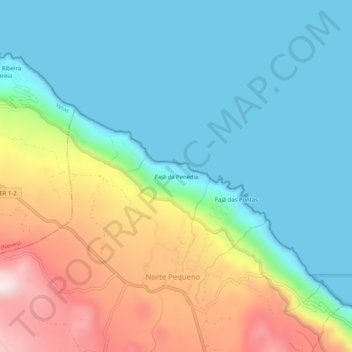
Name: Fajã da Penedia topographic map, elevation, terrain.
Location: Fajã da Penedia, Norte Pequeno, Calheta, Açores, Portugal (38.63854 -28.02104 38.67854 -27.98104)
Average elevation: 682 ft
Minimum elevation: 0 ft
Maximum elevation: 2,257 ft
Other topographic maps
Click on a map to view its topography, its elevation and its terrain.