
Trepalle topographic map
Click on the map to display elevation.
Trepalle
Trepalle is a village (the highest in Italy) in the Italian Alps, a frazione of Livigno, Lombardy. It is sometimes considered to be the village located at the highest altitude in Europe with its church located at an altitude of 2,069 m, and the village stretching up to the Passo d'Eira at 2,209 m. However, Kurush in southern Dagestan in Russia is situated much higher at 2480–2560 m in the northern Caucasus Mountains.
About this map
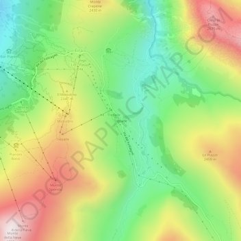
Name: Trepalle topographic map, elevation, terrain.
Average elevation: 7,336 ft
Minimum elevation: 5,958 ft
Maximum elevation: 9,124 ft