Geolocate

Paskuqan topographic map

Click on the map to display elevation.

About this map

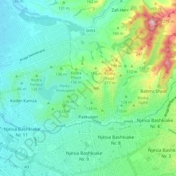
Name: Paskuqan topographic map, elevation, terrain.

Location: Paskuqan, Kamez, Tirana County, Central Albania, 1047, Albania (41.34792 19.77657 41.37836 19.85505)

Average elevation: 390 ft

Minimum elevation: 200 ft

Maximum elevation: 994 ft

Gear up for your next adventure:

🪵Folding Camp Saw - Compact saw for wood and campsite work
📦Gear Storage Bags - Organize and protect outdoor equipment
🌄Hiking Binoculars - Compact binoculars for scenic views and trail spotting
🥄Camping Utensil Set - Lightweight utensils for outdoor meals
🌡️Handheld Weather Meters - Measure wind, temp, and pressure for safe mountain travel

As an Amazon Associate, this site earns from qualifying purchases at no extra cost to you.