
Reitz topographic map
Click on the map to display elevation.
Reitz
Reitz is located in the north-eastern part of the Free State province, 300 kilometres (190 mi) north-east of Bloemfontein and 180 kilometres (110 mi) south of Johannesburg. It lies roughly halfway between the towns of Bethlehem and Frankfort, at an elevation of 1,630 metres (5,350 ft).
About this map
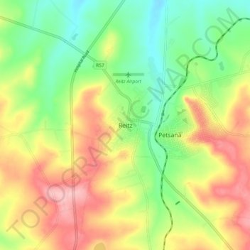
Name: Reitz topographic map, elevation, terrain.
Average elevation: 5,407 ft
Minimum elevation: 5,200 ft
Maximum elevation: 5,656 ft
Other topographic maps
Click on a map to view its topography, its elevation and its terrain.
Renoster River
South Africa > Free State > Thabo Mofutsanyana District Municipality > Nketoana Local Municipality
Average elevation: 5,207 ft
Renoster River
South Africa > Free State > Thabo Mofutsanyana District Municipality > Nketoana Local Municipality > Petrus Steyn
Average elevation: 5,571 ft