
Thank you for supporting this site ❤️
Make a donation
Make a donation
Gear up for your next adventure:
As an Amazon Associate, this site earns from qualifying purchases at no extra cost to you.
Cortiçal topographic map
Click on the map to display elevation.
Thank you for supporting this site ❤️
Make a donation
Make a donation
Gear up for your next adventure:
As an Amazon Associate, this site earns from qualifying purchases at no extra cost to you.
About this map
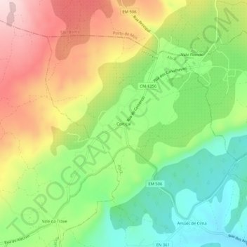
Name: Cortiçal topographic map, elevation, terrain.
Location: Cortiçal, Abrã, Santarém, 2835-333, Portugal (39.44506 -8.79289 39.48506 -8.75289)
Average elevation: 827 ft
Minimum elevation: 344 ft
Maximum elevation: 1,444 ft
Thank you for supporting this site ❤️
Make a donation
Make a donation
Gear up for your next adventure:
As an Amazon Associate, this site earns from qualifying purchases at no extra cost to you.