
Darnah topographic map
Click on the map to display elevation.
About this map
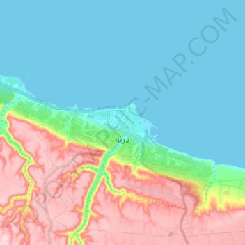
Name: Darnah topographic map, elevation, terrain.
Location: Darnah, Derna, Libya (32.74005 22.55676 32.79145 22.68429)
Average elevation: 285 ft
Minimum elevation: -3 ft
Maximum elevation: 912 ft
Other topographic maps
Click on a map to view its topography, its elevation and its terrain.