Geolocate

Pescul topographic map

Click on the map to display elevation.

About this map

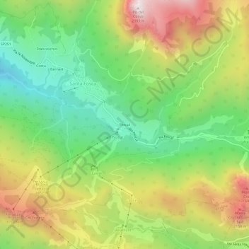
Name: Pescul topographic map, elevation, terrain.

Location: Pescul, Santa Fosca, Selva di Cadore, Belluno, Veneto, Italy (46.41741 12.05148 46.45741 12.09148)

Average elevation: 5,587 ft

Minimum elevation: 4,029 ft

Maximum elevation: 7,736 ft

Gear up for your next adventure:

🌄Hiking Binoculars - Compact binoculars for scenic views and trail spotting
🧭Orienteering Set - Complete compass and map reading kit
🥤Water Filter Bottle - All‑in‑one filter bottle for safe hydration
🔭Telescopic Hiking Pole - Adjustable pole for hiking stability
🛰️Handheld GPS Units - Professional satellite navigators for precise backcountry mapping

As an Amazon Associate, this site earns from qualifying purchases at no extra cost to you.