
Boriñes topographic map
Click on the map to display elevation.
About this map
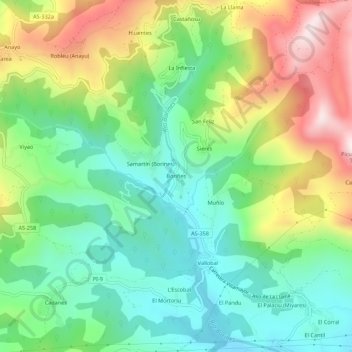
Name: Boriñes topographic map, elevation, terrain.
Location: Boriñes, Piloña, Asturias, 22534, Spain (43.37214 -5.33874 43.41214 -5.29874)
Average elevation: 1,017 ft
Minimum elevation: 358 ft
Maximum elevation: 2,162 ft