
Thank you for supporting this site ❤️
Make a donation
Make a donation
Gear up for your next adventure:
As an Amazon Associate, this site earns from qualifying purchases at no extra cost to you.
Montepiano topographic map
Click on the map to display elevation.
Thank you for supporting this site ❤️
Make a donation
Make a donation
Gear up for your next adventure:
As an Amazon Associate, this site earns from qualifying purchases at no extra cost to you.
About this map
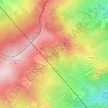
Name: Montepiano topographic map, elevation, terrain.
Location: Montepiano, Firenzuola, Firenze, Toscane, 50033, Italië (44.19976 11.39225 44.19986 11.39235)
Average elevation: 2,520 ft
Minimum elevation: 1,696 ft
Maximum elevation: 3,120 ft
Thank you for supporting this site ❤️
Make a donation
Make a donation
Gear up for your next adventure:
As an Amazon Associate, this site earns from qualifying purchases at no extra cost to you.