Geolocate

Harpole topographic map

Click on the map to display elevation.
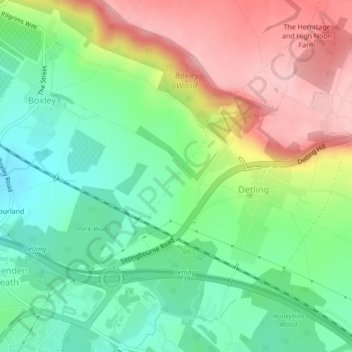
About this map

Name: Harpole topographic map, elevation, terrain.

Location: Harpole, Detling, Maidstone, Kent, England, ME14 3ET, United Kingdom (51.29533 0.55906 51.29616 0.56036)

Average elevation: 338 ft

Minimum elevation: 115 ft

Maximum elevation: 653 ft

Other topographic maps

Click on a map to view its topography, its elevation and its terrain.

Detling

United Kingdom > England > Kent > Maidstone > Detling

Average elevation: 449 ft

Detling

United Kingdom > England > Kent > Maidstone > Detling

Average elevation: 449 ft

Gear up for your next adventure:

🪶Camp Gear Gift Set - Perfect gift bundle for outdoor fans
🔥Fast-Boil Camping Stoves - Efficient cooking systems for quick trail meals
🧭Map Reading Tools - Tools and kits for map navigation
🧥Men's Rain Shells - Premium waterproof and breathable jackets for mountain weather
Backpacking Tents - Weight-optimized shelters for multi-day topographic surveys

As an Amazon Associate, this site earns from qualifying purchases at no extra cost to you.