Geolocate

Puffin Island topographic map

Click on the map to display elevation.

About this map

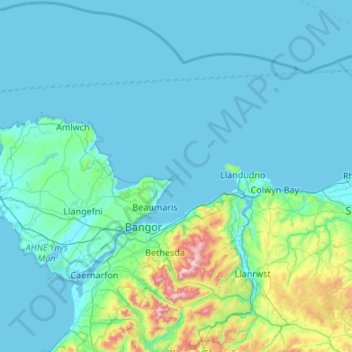
Name: Puffin Island topographic map, elevation, terrain.

Location: Puffin Island, Isle of Anglesey, Wales, LL58 8RP, United Kingdom (52.99882 -4.34685 53.63882 -3.70685)

Average elevation: 308 ft

Minimum elevation: 0 ft

Maximum elevation: 3,474 ft

Other topographic maps

Click on a map to view its topography, its elevation and its terrain.

Puffin Island

United Kingdom > Wales > Isle of Anglesey

Average elevation: 3 ft

Gear up for your next adventure:

🧤Hiking Gloves - Protective gloves for rugged trails
📶Satellite Messenger - Communication device off‑grid
🌧️Backpack Rain Cover - Keep gear dry in wet weather
🧢Sun Protection Hats - Wide-brimmed and UPF-rated hats for high-altitude sun safety
📦Gear Storage Bags - Organize and protect outdoor equipment

As an Amazon Associate, this site earns from qualifying purchases at no extra cost to you.