Geolocate

Talahiban II topographic map

Click on the map to display elevation.

👉 Easily get elevation data in JSON, GeoTIFF and KML formats using Elevation API
Thank you for supporting this site ❤️
Make a donation

About this map

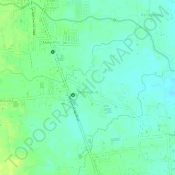
Name: Talahiban II topographic map, elevation, terrain.

Location: Talahiban II, San Juan, Batangas, Calabarzon, Philippines (13.80090 121.39997 13.82038 121.41712)

Average elevation: 49 ft

Minimum elevation: 20 ft

Maximum elevation: 82 ft

Other topographic maps

Click on a map to view its topography, its elevation and its terrain.

Lawaye

Philippines > Batangas > San Juan > Pinagbayanan

Average elevation: 16 ft

Bulihan

Philippines > Batangas > San Juan > Janaojanao > Bulihan

Average elevation: 72 ft

Gear up for your next adventure:

🔌Solar Panel Charger - Charge gear sustainably outdoors
🪶Camping Sleeping Pad - Comfortable sleeping pad for backpacking
🔌USB Car Charger - Car charger for on‑the‑go power needs
👓Polarized Sunglasses - Outdoor sunglasses for glare reduction
🗺️Topographic Maps - Detailed topo maps for hiking, exploring and outdoor navigation

As an Amazon Associate, this site earns from qualifying purchases at no extra cost to you.