Geolocate

La Libertad topographic map

Click on the map to display elevation.

About this map

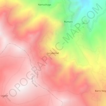
Name: La Libertad topographic map, elevation, terrain.

Location: La Libertad, Usquil, Otuzco, La Libertad, Perú (-7.88234 -78.40122 -7.84234 -78.36122)

Average elevation: 11,476 ft

Minimum elevation: 8,602 ft

Maximum elevation: 13,087 ft

Gear up for your next adventure:

🥤Water Filter Bottle - All‑in‑one filter bottle for safe hydration
🪶Compact Camp Shovel - Folding shovel for campsite tasks
🔥Plasma Lighters - Windproof lighters that work in any weather condition
👖Convertible Hiking Pants - Versatile zip-off pants for changing altitudes and temperatures
🔪Outdoor Multitools - Essential survival tools for gear repair and field use

As an Amazon Associate, this site earns from qualifying purchases at no extra cost to you.