
Thank you for supporting this site ❤️
Make a donation
Make a donation
Gear up for your next adventure:
As an Amazon Associate, this site earns from qualifying purchases at no extra cost to you.
Báguena topographic map
Click on the map to display elevation.
Thank you for supporting this site ❤️
Make a donation
Make a donation
Gear up for your next adventure:
As an Amazon Associate, this site earns from qualifying purchases at no extra cost to you.
About this map
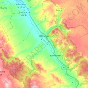
Name: Báguena topographic map, elevation, terrain.
Location: Báguena, Jiloca, Teruel, Aragon, Spain (40.99639 -1.41797 41.06568 -1.28302)
Average elevation: 3,077 ft
Minimum elevation: 2,503 ft
Maximum elevation: 3,763 ft
Thank you for supporting this site ❤️
Make a donation
Make a donation
Gear up for your next adventure:
As an Amazon Associate, this site earns from qualifying purchases at no extra cost to you.