
Thank you for supporting this site ❤️
Make a donation
Make a donation
Gear up for your next adventure:
As an Amazon Associate, this site earns from qualifying purchases at no extra cost to you.
Tianhuangping topographic map
Click on the map to display elevation.
Thank you for supporting this site ❤️
Make a donation
Make a donation
Gear up for your next adventure:
As an Amazon Associate, this site earns from qualifying purchases at no extra cost to you.
About this map
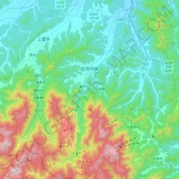
Name: Tianhuangping topographic map, elevation, terrain.
Location: Tianhuangping, Anji County, Huzhou, Zhejiang, China (30.42385 119.56515 30.58405 119.70582)
Average elevation: 1,214 ft
Minimum elevation: 115 ft
Maximum elevation: 4,081 ft
Thank you for supporting this site ❤️
Make a donation
Make a donation
Gear up for your next adventure:
As an Amazon Associate, this site earns from qualifying purchases at no extra cost to you.