Geolocate

Dongtan topographic map

Click on the map to display elevation.

About this map

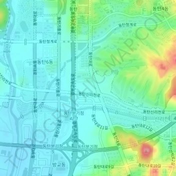
Name: Dongtan topographic map, elevation, terrain.

Location: Dongtan, Osan-dong, 동탄6동, Hwaseong-si, 18481, South Korea (37.17721 127.08840 37.19721 127.10840)

Average elevation: 151 ft

Minimum elevation: 72 ft

Maximum elevation: 423 ft

Gear up for your next adventure:

🏔️Mountain Trail Maps - High‑detail maps for popular peaks
🏕️Family Camping Gear - Essentials for group camping trips
📡Handheld GPS Device - Reliable handheld GPS for outdoor navigation
🧺Microfiber Travel Towels - Compact and fast-drying towels for trail use
👖Convertible Hiking Pants - Versatile zip-off pants for changing altitudes and temperatures

As an Amazon Associate, this site earns from qualifying purchases at no extra cost to you.