
Thank you for supporting this site ❤️
Make a donation
Make a donation
Gear up for your next adventure:
As an Amazon Associate, this site earns from qualifying purchases at no extra cost to you.
Barangay 3 topographic map
Click on the map to display elevation.
Thank you for supporting this site ❤️
Make a donation
Make a donation
Gear up for your next adventure:
As an Amazon Associate, this site earns from qualifying purchases at no extra cost to you.
About this map
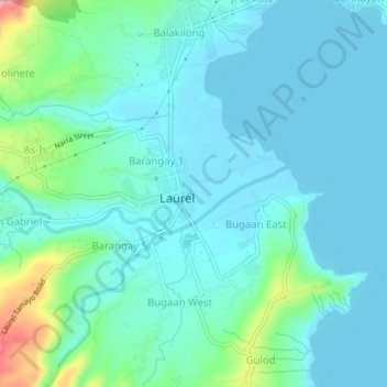
Name: Barangay 3 topographic map, elevation, terrain.
Location: Barangay 3, Laurel, Batangas, Calabarzon, 4221, Philippines (14.03090 120.91498 14.07090 120.95498)
Average elevation: 108 ft
Minimum elevation: 13 ft
Maximum elevation: 548 ft
Thank you for supporting this site ❤️
Make a donation
Make a donation
Gear up for your next adventure:
As an Amazon Associate, this site earns from qualifying purchases at no extra cost to you.