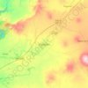
Arandas topographic map
Click on the map to display elevation.
Arandas
Arandas is situated on the Mesa Central at an elevation of 6,762 feet (2,061 metres). Arandas is commonly known among Mexicans as the commercial and manufacturing centre for agricultural products (typically beans and wheat) and its pastoral environment, which allows the city to produce various commercial products such as linseed oil, tequila, pottery, woollen blankets, and straw hats.
About this map
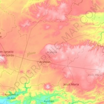
Name: Arandas topographic map, elevation, terrain.
Location: Arandas, Región Altos Sur, Jalisco, Mexico (20.58758 -102.55011 20.91108 -102.05151)
Average elevation: 6,663 ft
Minimum elevation: 5,121 ft
Maximum elevation: 7,874 ft
Other topographic maps
Click on a map to view its topography, its elevation and its terrain.
Ajijic
The Chapala Lake basin has a year-round average temperature of about 19 °C (66 °F). Due to Ajijic's tropical latitude and relatively high elevation, it is seldom unpleasantly hot or humid. The rainy season begins in June and lasts until October. The average rainfall is 793 millimetres (31.2 in). Even during…
Average elevation: 5,702 ft

Tequila
Tequila is one of the 124 municipalities of Jalisco, located just west of the center of the state. Its territory extends for 1689.11km2, with elevations that vary between 700 and 2,900 meters above sea level. The municipality borders with the main metropolitan region of Guadalajara to the east (Zapopan), and…
Average elevation: 4,157 ft


Capilla de Guadalupe
Mexico > Jalisco > Tepatitlán de Morelos > Capilla de Guadalupe
Average elevation: 6,722 ft