Geolocate

El Rodeo topographic map

Click on the map to display elevation.

About this map

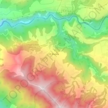
Name: El Rodeo topographic map, elevation, terrain.

Location: El Rodeo, Colón, Mora, San José, 10701, Costa Rica (9.89863 -84.28837 9.93863 -84.24837)

Average elevation: 2,543 ft

Minimum elevation: 1,677 ft

Maximum elevation: 3,356 ft

Gear up for your next adventure:

🚪Portable Camp Chair - Foldable chair for comfort at camp
🌎3D Topographic Globes - Raised relief globes for a tactile understanding of geography
🦶Carbon Trekking Poles - Reduce knee impact on steep descents with ultra-light poles
🩹Survival Bandages - High‑quality bandages for emergencies
🪶Paracord Bracelet - Survival bracelet with built‑in tools

As an Amazon Associate, this site earns from qualifying purchases at no extra cost to you.