
隔圳 topographic map
Interactive map
Click on the map to display elevation.
About this map
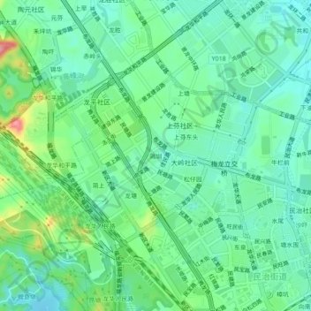
Name: 隔圳 topographic map, elevation, terrain.
Location: 隔圳, 民治街道, 龙华区, 深圳市, 广东省, 518110, 中国 (22.61817 113.99368 22.65817 114.03368)
Average elevation: 246 ft
Minimum elevation: 138 ft
Maximum elevation: 528 ft
Other topographic maps
Click on a map to view its topography, its elevation and its terrain.