Geolocate

Mayowe topographic map

Click on the map to display elevation.

About this map

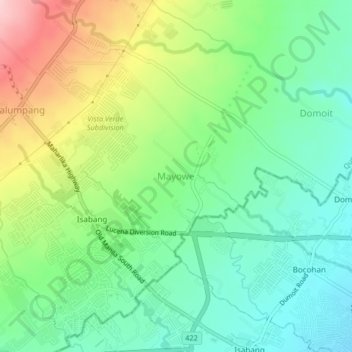
Name: Mayowe topographic map, elevation, terrain.

Location: Mayowe, Tayabas, Quezon, Calabarzon, 4327, Philippines (13.94835 121.55524 13.98835 121.59524)

Average elevation: 387 ft

Minimum elevation: 141 ft

Maximum elevation: 846 ft

Gear up for your next adventure:

🎒Waterproof Dry Bags - Keep your electronics and maps dry inside your pack
🧭Hiking Compass - Precision compass for reliable navigation in the wilderness
🌄Hiking Binoculars - Compact binoculars for scenic views and trail spotting
🪶Compact Camp Shovel - Folding shovel for campsite tasks
📶Vehicle Signal Boosters - Improve reception in rural areas while driving to trailheads

As an Amazon Associate, this site earns from qualifying purchases at no extra cost to you.