
Pedro Vicente Maldonado topographic map
Interactive map
Click on the map to display elevation.
Pedro Vicente Maldonado
Pedro Vicente Maldonado is a city in the Pichincha province of Ecuador and the capital of Pedro Vicente Maldonado Canton. It is located on the right bank of the Caoní River, to the northwest of the province, on the outer flanks of the western cordillera of the Andes, at an altitude of 605 m and with a rainy tropical climate of 23°C on average.
About this map
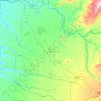
Name: Pedro Vicente Maldonado topographic map, elevation, terrain.
Location: Pedro Vicente Maldonado, Pichincha, 171201, Ecuador (0.00006 -79.17922 0.32176 -78.93198)
Average elevation: 1,768 ft
Minimum elevation: 459 ft
Maximum elevation: 5,732 ft