
Thank you for supporting this site ❤️
Make a donation
Make a donation
Gear up for your next adventure:
As an Amazon Associate, this site earns from qualifying purchases at no extra cost to you.
Tannheimer Tal topographic map
Click on the map to display elevation.
Thank you for supporting this site ❤️
Make a donation
Make a donation
Gear up for your next adventure:
As an Amazon Associate, this site earns from qualifying purchases at no extra cost to you.
About this map
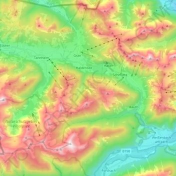
Name: Tannheimer Tal topographic map, elevation, terrain.
Location: Tannheimer Tal, Grän, Bezirk Reutte, Tirol, Österreich (47.43990 10.45188 47.52792 10.64375)
Average elevation: 4,698 ft
Minimum elevation: 2,684 ft
Maximum elevation: 7,356 ft
Thank you for supporting this site ❤️
Make a donation
Make a donation
Gear up for your next adventure:
As an Amazon Associate, this site earns from qualifying purchases at no extra cost to you.