
Thank you for supporting this site ❤️
Make a donation
Make a donation
Gear up for your next adventure:
As an Amazon Associate, this site earns from qualifying purchases at no extra cost to you.
Singahalli topographic map
Click on the map to display elevation.
Thank you for supporting this site ❤️
Make a donation
Make a donation
Gear up for your next adventure:
As an Amazon Associate, this site earns from qualifying purchases at no extra cost to you.
About this map
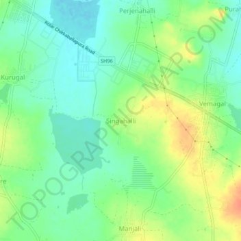
Name: Singahalli topographic map, elevation, terrain.
Location: Singahalli, Kolar taluk, Kolar District, Karnataka, India (13.16949 77.98372 13.20949 78.02372)
Average elevation: 2,799 ft
Minimum elevation: 2,743 ft
Maximum elevation: 2,884 ft
Thank you for supporting this site ❤️
Make a donation
Make a donation
Gear up for your next adventure:
As an Amazon Associate, this site earns from qualifying purchases at no extra cost to you.