
Thank you for supporting this site ❤️
Make a donation
Make a donation
Gear up for your next adventure:
As an Amazon Associate, this site earns from qualifying purchases at no extra cost to you.
Danao topographic map
Click on the map to display elevation.
Thank you for supporting this site ❤️
Make a donation
Make a donation
Gear up for your next adventure:
As an Amazon Associate, this site earns from qualifying purchases at no extra cost to you.
About this map
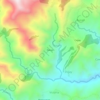
Name: Danao topographic map, elevation, terrain.
Location: Danao, Ayubo (Leon), Iloilo, Western Visayas, Philippines (10.83250 122.26478 10.87250 122.30478)
Average elevation: 1,949 ft
Minimum elevation: 902 ft
Maximum elevation: 3,694 ft
Thank you for supporting this site ❤️
Make a donation
Make a donation
Gear up for your next adventure:
As an Amazon Associate, this site earns from qualifying purchases at no extra cost to you.