
Hallim-eup topographic map
Click on the map to display elevation.
About this map
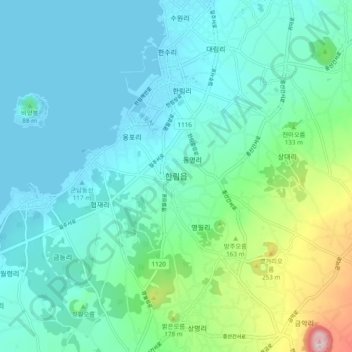
Name: Hallim-eup topographic map, elevation, terrain.
Location: Hallim-eup, Jeju, 63014, South Korea (33.35344 126.22684 33.43344 126.30684)
Average elevation: 253 ft
Minimum elevation: -3 ft
Maximum elevation: 1,345 ft
Other topographic maps
Click on a map to view its topography, its elevation and its terrain.