
Quemado topographic map
Interactive map
Click on the map to display elevation.
About this map
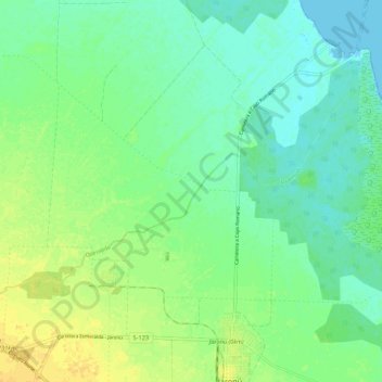
Name: Quemado topographic map, elevation, terrain.
Location: Quemado, Esmeralda, Camagüey, Cuba (21.84121 -78.02397 21.90513 -77.91601)
Average elevation: 33 ft
Minimum elevation: -3 ft
Maximum elevation: 79 ft
Other topographic maps
Click on a map to view its topography, its elevation and its terrain.