
Thank you for supporting this site ❤️
Make a donation
Make a donation
Gear up for your next adventure:
As an Amazon Associate, this site earns from qualifying purchases at no extra cost to you.
Mandli topographic map
Click on the map to display elevation.
Thank you for supporting this site ❤️
Make a donation
Make a donation
Gear up for your next adventure:
As an Amazon Associate, this site earns from qualifying purchases at no extra cost to you.
About this map
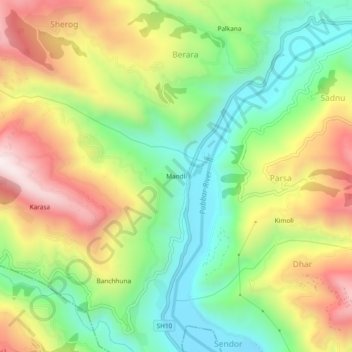
Name: Mandli topographic map, elevation, terrain.
Location: Mandli, Parsa, Rohru, Shimla, Himachal Pradesh, 171207, India (31.16149 77.70495 31.20149 77.74495)
Average elevation: 5,778 ft
Minimum elevation: 4,734 ft
Maximum elevation: 7,178 ft
Thank you for supporting this site ❤️
Make a donation
Make a donation
Gear up for your next adventure:
As an Amazon Associate, this site earns from qualifying purchases at no extra cost to you.