
Thank you for supporting this site ❤️
Make a donation
Make a donation
Gear up for your next adventure:
As an Amazon Associate, this site earns from qualifying purchases at no extra cost to you.
Panillo topographic map
Click on the map to display elevation.
Thank you for supporting this site ❤️
Make a donation
Make a donation
Gear up for your next adventure:
As an Amazon Associate, this site earns from qualifying purchases at no extra cost to you.
About this map
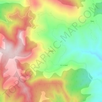
Name: Panillo topographic map, elevation, terrain.
Location: Panillo, Graus, Ribagorza, Huesca, Aragón, España (42.21688 0.28050 42.25688 0.32050)
Average elevation: 2,795 ft
Minimum elevation: 1,818 ft
Maximum elevation: 3,812 ft
Thank you for supporting this site ❤️
Make a donation
Make a donation
Gear up for your next adventure:
As an Amazon Associate, this site earns from qualifying purchases at no extra cost to you.