Geolocate

Cabane de Tracuit CAS topographic map

Interactive map

Click on the map to display elevation.

About this map

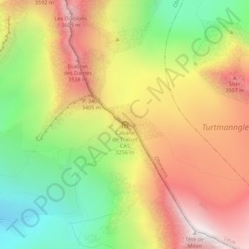
Name: Cabane de Tracuit CAS topographic map, elevation, terrain.

Location: Cabane de Tracuit CAS, Chemin des Arolles, Zinal, Anniviers, Sierre, Valais, 3961, Suisse (46.13018 7.67922 46.13044 7.67961)

Average elevation: 10,256 ft

Minimum elevation: 8,432 ft

Maximum elevation: 12,054 ft

Other topographic maps

Click on a map to view its topography, its elevation and its terrain.

Pralong

Suisse > Valais > Sierre > Anniviers > Zinal > Pralong

Pralong, Zinal, Anniviers, Sierre, Valais, 3961, Suisse

Average elevation: 7,024 ft

Le Bouillet

Suisse > Valais > Sierre > Anniviers > Zinal

Le Bouillet, Zinal, Anniviers, Sierre, Valais, 3961, Suisse

Average elevation: 7,110 ft