
Thank you for supporting this site ❤️
Make a donation
Make a donation
Gear up for your next adventure:
As an Amazon Associate, this site earns from qualifying purchases at no extra cost to you.
Ayata topographic map
Click on the map to display elevation.
Thank you for supporting this site ❤️
Make a donation
Make a donation
Gear up for your next adventure:
As an Amazon Associate, this site earns from qualifying purchases at no extra cost to you.
About this map
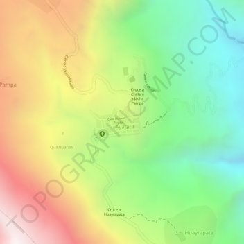
Name: Ayata topographic map, elevation, terrain.
Location: Ayata, Municipio Ayata, Provincia Muñecas, La Paz, Bolivia (-15.46066 -68.83812 -15.45715 -68.83251)
Average elevation: 10,735 ft
Minimum elevation: 9,193 ft
Maximum elevation: 12,487 ft
Thank you for supporting this site ❤️
Make a donation
Make a donation
Gear up for your next adventure:
As an Amazon Associate, this site earns from qualifying purchases at no extra cost to you.