
Thank you for supporting this site ❤️
Make a donation
Make a donation
Gear up for your next adventure:
As an Amazon Associate, this site earns from qualifying purchases at no extra cost to you.
Balitoc topographic map
Click on the map to display elevation.
Thank you for supporting this site ❤️
Make a donation
Make a donation
Gear up for your next adventure:
As an Amazon Associate, this site earns from qualifying purchases at no extra cost to you.
About this map
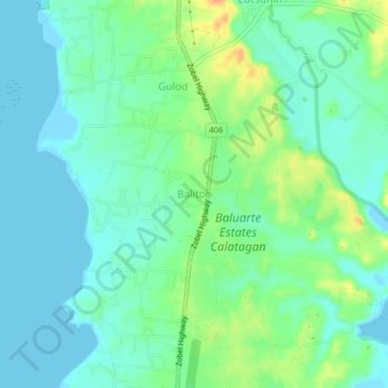
Name: Balitoc topographic map, elevation, terrain.
Location: Balitoc, Calatagan, Batangas, Calabarzon, 4215, Philippines (13.84198 120.61409 13.88198 120.65409)
Average elevation: 43 ft
Minimum elevation: -3 ft
Maximum elevation: 138 ft
Thank you for supporting this site ❤️
Make a donation
Make a donation
Gear up for your next adventure:
As an Amazon Associate, this site earns from qualifying purchases at no extra cost to you.